 PermitNav
Built for oversize/overweight moves
PermitNav turns your state oversize/overweight (OSOW) permit into the route it authorizes, with truck turn-by-turn navigation, so you stay on the permitted roads instead of a generic GPS line.
From the permit to a checked route
Reads your permit
Snap a photo, scan the pages with the camera, or upload the PDF. PermitNav reads the routing table, dimensions and conditions automatically.
Follows the named roads
It rebuilds the route road by road across the roads your permit names, in the order it lists them, and checks it against the permit, not the fastest detour.
Shows what the permit says
The review screen shows the permit's width, height, length and gross weight, its dates, any movement-time restriction, and its special conditions, word for word.
Flags questionable segments
Each permit route shows how far it's verified — Verified, Check N items or Approximate — and why, with every flagged spot on the map. Check each one against your permit before you roll.
Multi-state trips
Carrying permits for several states on one move? Chain them into a single end-to-end route across state lines.
Heavy-haul aware
Routing accounts for your vehicle and load dimensions, so guidance fits the truck you're actually driving.
Guidance that stays on the permitted route
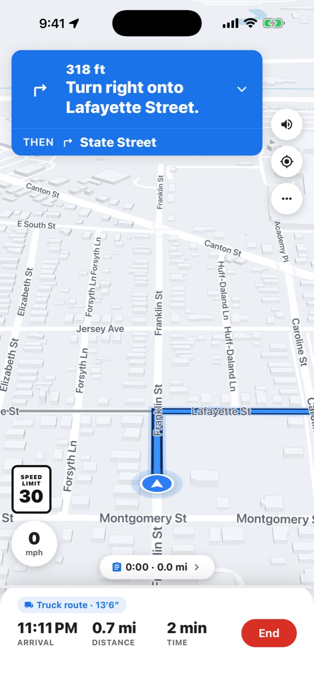
Turn-by-turn navigation
Clear voice and on-screen guidance that follows the permitted route. Exit numbers on the turn card on permit and truck routes, and “X, then Y” prompts where turns come close together.
Off-route alerts
Off-route alerts within seconds, and “Guide me back” turn-by-turn to the permitted route (needs a connection).
Bridge and clearance alerts
Alerts ahead of posted bridges and low clearances on your permit route — about 2 miles and half a mile out — from NYSDOT's posted-bridge and clearance registers in New York, PennDOT's low-clearance, posted-road and safety-restricted registers on Pennsylvania's permitted roads, and posted heights, widths and weights mapped in OpenStreetMap in every state.
Travel windows and curfews
Your permit's travel windows are shown before you start and announced during the drive — before a window closes or the permit expires — and printed curfews are called out. Reminders only.
Keeps guiding in the background
Guidance keeps running with the screen locked or the app in the background — your next turn on the Lock Screen (iPhone) or in an ongoing notification (Android). A drive parked 30 minutes in the background pauses until you open PermitNav.
CarPlay and Android Auto
Turn-by-turn on the car screen with CarPlay or Android Auto. With CarPlay, Mute, Overview and zoom buttons, and your next turn on the CarPlay Dashboard.
Kentucky (KYTC) and Missouri (MoDOT) bridge advisories are marked on the map. For other states, Tennessee included, no state restriction data is checked: the issuing agency settles whether the roads suit the load. Read your permit's conditions and verify the route before driving.
The rest of the toolkit
Truck route builder
Search a destination and go, routed for your saved truck. Included with every plan. Each stop of a multi-stop truck trip is announced: “Arrived at stop N”.
Saved permits and routes
Your permits are kept on your account, and your last permit list stays on the phone for when there's no signal. Permit routes are kept in your account's route history; truck routes you save from the map stay on your phone.
Driving log
A driving log records each drive PermitNav guides — its miles and miles by state — and totals your completed permit trips.
Route issue reports
Report a problem with a route from the app. We review every report.
Car navigation is free. Truck routing and permit reads come with a plan. See pricing.
Permits we read today
PermitNav reads oversize/overweight permits from these eleven states.
Driving in another state? Send us its permits and see how close it is.
Your permit. Your route.
Turn-by-turn.
OSOW truck navigation for New York, Pennsylvania, Kentucky, Tennessee, Missouri, Texas, Maryland, Ohio, Indiana, Oklahoma and Illinois permits.